Hydrologic Studies & Flood Plain Analysis
Water Resources

Hydrologic Studies & Flood Plain Analysis

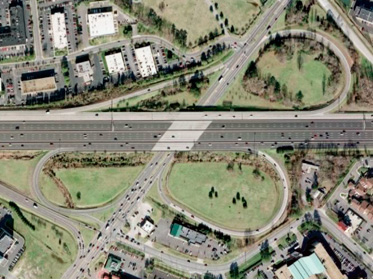
Our water resource engineers have extensive knowledge in hydrologic/hydraulic studies, watershed assessments and floodplain analyses. We also have extensive expertise in river mechanics, waterway opening studies and scour analyses for bridges. Drainage evaluation expertise includes complex stormdrains, multicell culverts, roadside ditches, outfall stabilizations and stream diversions.

detail-scour

Argonne Drive Bridge Scour Protection, City of Baltimore, MD

detail-witchduck

1-264 Witchduck Interchange

Featured Work

Hydrologic Studies & Flood Plain Analysis Projects

  • 1 of 3

    I-264/ Witchduck Road Interchange and Ramp Extension

    Virginia Department of Transportation

    RJM Engineering provided design services for Route I-264 Interchange Improvements and Route I-264 Witchduck Road Interchange and Ramp Extension projects. Services included hydrologic/hydraulic studies, preparation of drainage design and stormwater management, as well as river mechanics studies and flood plain analysis for the existing stream. Drainage design services for the roadway design included design of roadside ditches, closed storm drain systems and design of stormwater management facilities to compensate for the new impervious pavements.

    River mechanic analyses were performed for Millcreek and a major unnamed tributary along the project reach. This study investigated the backwater effects along Millcreek in both existing and proposed conditions. All work was performed in accordance with the VDOT Drainage Manual guidelines and applicable technical supplements.

    water-264-01-sm

    Services Provided

    • Hydrologic/hydraulic studies
    • River mechanics studies
    • Drainage design
    • Stormwater management

  • 2 of 3

    Rehabilitation and Replacement of the Argonne Drive Bridge over Herring Run

    City of Baltimore

    RJM Engineering, Inc. prepared floodplain studies for Herring Run to evaluate the scour potential at Argonne Drive Bridge and to develop stream bank stabilization techniques. Hydrologic analysis and flood peak flows were estimated using GIS Hydro 2000 and TR-20 computer programs. HEC-RAS was used to estimate flood discharges for 2, 10, 100 and 500-year storm events and velocities in the project area. ABSCOUR software and HEC-18 manual were used to evaluate scour potential for 500-year storm. Additional studies included evaluation of slope stability of Herring Run banks at several locations. Geotechnical investigations were undertaken to determine the subsurface condition. Stone rip-rap protection for scour countermeasures was developed for stream bank and bridge pier protection.

    Stream restoration studies were performed in the vicinity of the bridge substructure and minor stream channel relocation was designed. Construction permits were coordinated with MDE and US Army COE for work in the floodplain. Construction cost estimates were prepared for stream bank stabilization and scour protection measures.

    water-argonne-01-sm

    Services Provided

    • Flood plain study
    • Scour analysis
    • Geotechnical investigation
    • Construction permitting

  • 3 of 3

    .

    H/H Studies and Floodplain Analyses Statewide

    Maryland State Highway Administration

    RJM provided hydrologic, hydraulic, and scour analyses for multiple road and bridge projects in Maryland. One project was the replacement of the existing bridge on Potomac Hollow Road over Moores Run in Allegany County. As a sub-consultant, RJM performed existing and ultimate land use conditions, hydrologic analysis using GIS Hydro and TR-20, performed existing and proposed conditions riverine hydraulic analyses using HEC-RAS, performed scour analysis using ABSCOUR9, prepared H&H and Scour Report including relevant maps and CAD drawings, and prepared final H&H and Scour Report.

    In a second example project, sections of MD 404 on the Eastern Shore were flooded frequently. As a sub-consultant, RJM provided a hydrologic study to establish the limits of a 100-year flood plain. GIS Hydro 2000 and TR-20 computer programs were used to estimate peak discharges and HEC-RAS was used to establish water surface elevation. A combination of alternatives was used to mitigate the flood impact, including installing levees to create flood storage up-stream, enlarging existing culverts and modifying downstream channels.

    water-hh-studies-01-sm

    Services Provided

    • Hydrologic/hydraulic analyses
    • Scour analyses
    • Flood plain studies